


Author: Jan Babirecki
Year: c. 1900
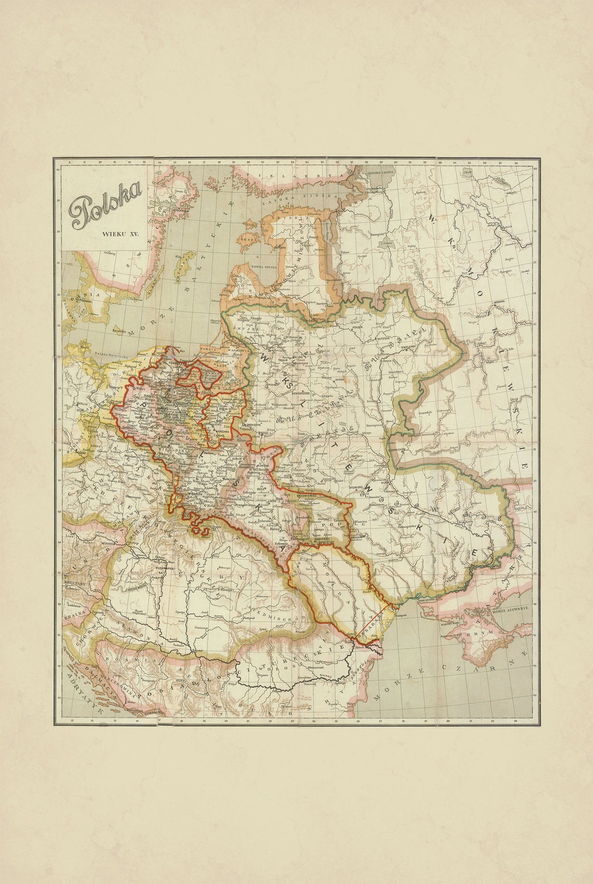
This is a reproduction print of the historical map “Polska wieku XV” (Poland in the 15th Century), created and drawn by Jan Babirecki around 1900, with historical content associated with historian Władysław Smoleński.
The map presents Poland during the 15th century, illustrating the country's historical geography during the Jagiellonian era. Cities, regions, borders, rivers and other geographical features are carefully marked, while hachures are used to represent the terrain.
The original was produced as a multicolor lithograph measuring approximately 50 × 43 cm and printed by Karol Kranikowski’s lithographic workshop in Kraków.
The map was published as an supplement to various editions of Władysław Smoleński’s “Dzieje narodu polskiego” (History of the Polish Nation), combining historical scholarship with detailed turn-of-the-century Polish cartography.