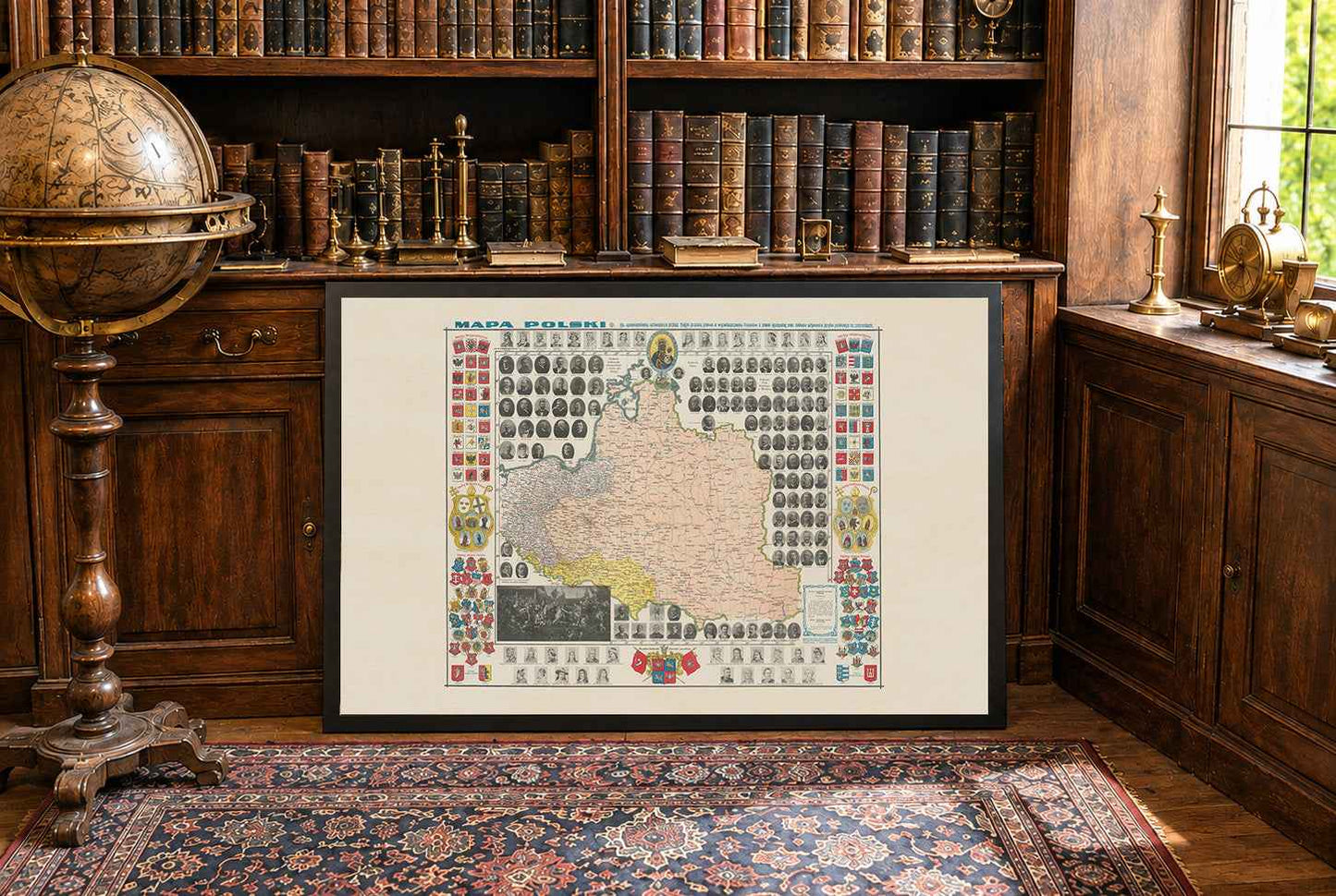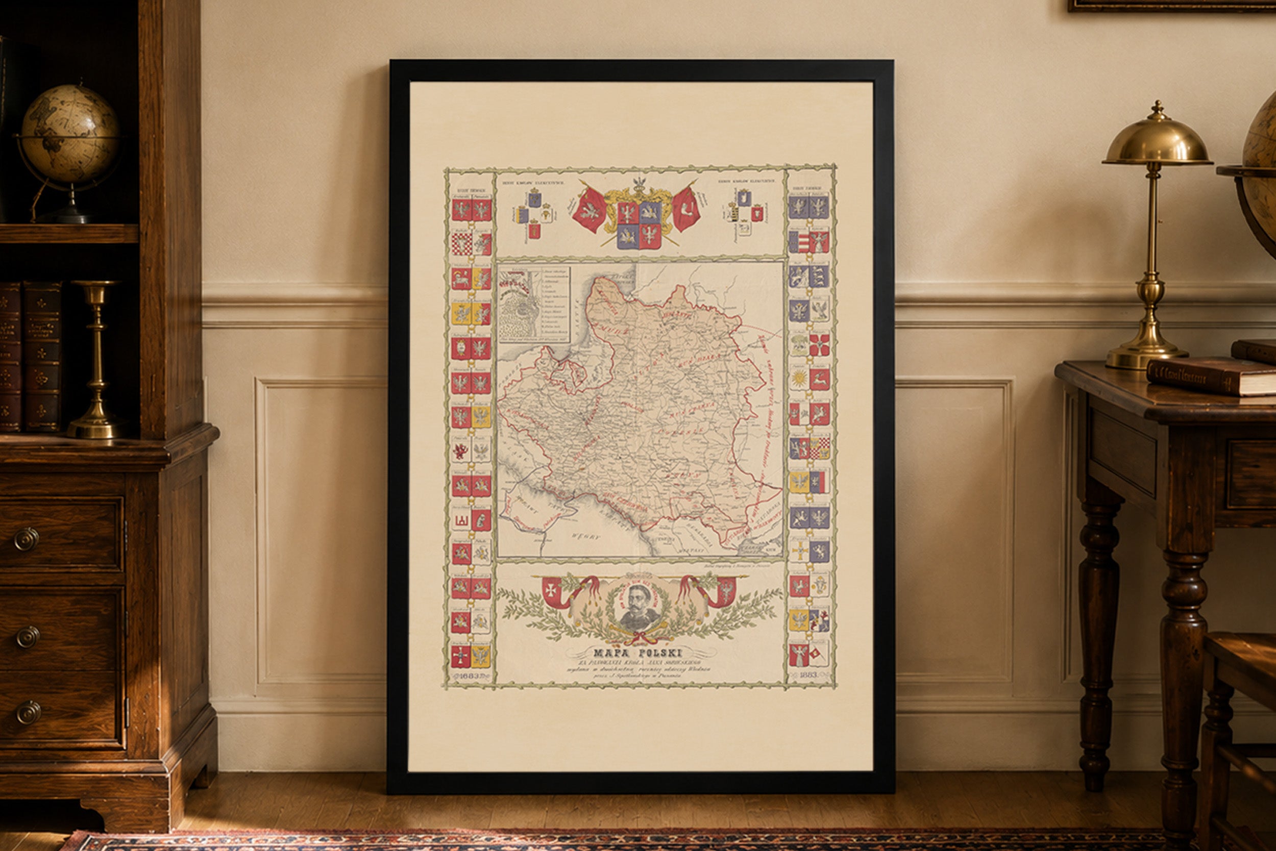


Entdecken Sie mit diesem bemerkenswerten Poster der historischen Polenkarte, das um 1910 vom Verleger Stanisław Tomaszewski geschaffen wurde, eines der außergewöhnlichsten patriotischen kartografischen Werke, die je in Polen veröffentlicht wurden. Dieses reich illustrierte Werk entstand während der letzten Jahre der Teilungen Polens und erinnert an den polnischen Kampf gegen die antipolnische Politik der preußischen Behörden, einschließlich der Enteignung polnischer Grundbesitzer und der Einschränkungen des öffentlichen Gebrauchs der polnischen Sprache.
Diese Karte ist mehr als eine historische Landkarte: Sie ist eine beeindruckende visuelle Würdigung von über tausend Jahren polnischer Geschichte und nationaler Identität.
Im Zentrum befindet sich eine detailreiche Karte der historischen polnischen Gebiete mit Städten, Flüssen, Eisenbahnlinien, Verwaltungsgrenzen und zahlreichen historischen Schlachtfeldern, die die Vergangenheit der Nation prägten. Trotz der damaligen politischen Teilung Polens stellt die Karte das Land als eine einheitliche historische Heimat dar.
Die Karte ist von einer außergewöhnlichen historischen Galerie umgeben, die Porträts nahezu aller Herrscher Polens zeigt, beginnend mit Mieszko I. und fortgeführt durch die Piasten, Jagiellonen, gewählten Monarchen und späteren Herrscher. Neben ihnen sind Porträts polnischer Vertreter zu sehen, die im Deutschen Reichstag, im Preußischen Landtag, in der Russischen Duma und im Polnischen Kreis in Wien tätig waren und den politischen Kampf für polnische Rechte im frühen zwanzigsten Jahrhundert dokumentieren.
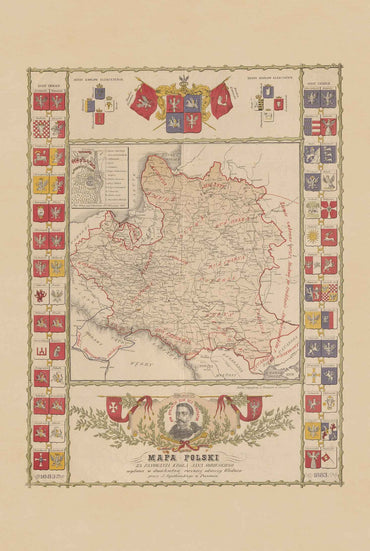
Der dekorative Rahmen ist ebenso bemerkenswert: Er zeigt 54 Wappen der Provinzen, 52 historische Stadtwappen, 14 Bistumswappen, die heraldischen Zeichen königlicher Dynastien und zahlreiche nationale Symbole. Über der Karte wacht das verehrte Bild der Schwarzen Madonna von Tschenstochau gemeinsam mit einer Ansicht des Klosters Jasna Góra über die Komposition und unterstreicht das geistliche Erbe der polnischen Nation.
Zu den ikonischsten Elementen der Karte gehören Reproduktionen von Jan Matejkos Meisterwerk Die preußische Huldigung (Hołd Pruski) sowie Auszüge aus den preußischen Gesetzen, die sich gegen polnischen Landbesitz richteten und den öffentlichen Gebrauch der polnischen Sprache verboten. Diese Ergänzungen machen die Karte zu einem eindrucksvollen historischen Zeugnis des polnischen Widerstands gegen die Germanisierung.
Diese großartige Komposition vereint historische Kartografie, Porträtkunst, Heraldik, politische Geschichte, religiöse Symbolik und bildende Kunst und zählt zu den aufwendigsten patriotischen Karten, die je geschaffen wurden. Sie ist ein außergewöhnliches Stück für Historiker, Sammler, Genealogen, Pädagogen und alle, die sich für das polnische Erbe begeistern.
Dies ist ein Reproduktionsdruck einer historischen Karte
Autor: Stanisław Tomaszewski